
Inside Passage and Klondike Loop to Alaska – 1,195 miles plus 3 to 10 days ferry travel time.
This itinerary combines ferry travel on the Alaska Marine Highway through the Inside Passage with the Klondike Loop route into Alaska. Reserve in advance for ferry travel.
Inside Passage
This sample itinerary allows 8 to 10 days for exploring Southeast Alaska by ferry and road. Or you can choose to stay on the ferry for the 3-day trip from Bellingham to Skagway.

Ketchikan
Ketchikan is first port of call in Alaska. The morning arrival allows you much of the day to explore the town and approximately 30 miles of road. Saxman Totem Park is just 2 miles from downtown; Totem Bight State Historical Park is just 10 miles north.

Prince of Wales Island
The following day, take the Inter-Island Ferry Authority (IFA) from Ketchikan to Hollis on Prince of Wales Island, the third largest island under the American flag. Spend a full day exploring the island and return to Ketchikan the next day and ride the mainline state ferry route to Wrangell.

(©Kris Valencia, staff)
Wrangell
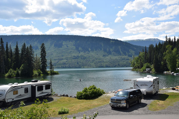
Wrangell attractions include Chief Shakes Island and Tribal House in the harbor. If you have time, charter a boat to Anan Wildlife Observatory to see bears or up the Stikine River to see glorious scenery. Experience one of the best campground views in Alaska at Nemo Point.

(©Sharon Nault)
Petersburg
Depart Wrangell for Petersburg with the Alaska Marine Highway. (State ferries dock a short walk from downtown.) Petersburg attractions include whale watching and tours out to LeConte Glacier.

(©Travel Juneau)
Juneau
From Petersburg, continue by ferry to Juneau, Alaska’s capital. Allow time to see Mendenhall Glacier and other Juneau sights. Continue by ferry to Skagway, home of Klondike Gold Rush National Historical Park. Don’t miss the White Pass & Yukon Route Railway excursion out of Skagway!

(©Kris Valencia, staff)
South Klondike Highway
It is only a 2.5-hour drive from Skagway, AK, to Whitehorse, YT, via the South Klondike Highway and it is a beautiful drive in clear weather. After sightseeing in Whitehorse, drive up the Alaska Highway a few miles and turn on to the North Klondike Highway to Dawson City, which forms the first part of the Klondike Loop. It is a day’s drive from Whitehorse, capital of Yukon, to Dawson City, the first capital of Yukon, longer if you allow time to visit Eclipse Nordic Hot Springs and the Yukon Wildlife Preserve.

(©Government of Yukon/R Hartmier)
Top of the World Highway
Cross the Yukon River by ferry at Dawson City and follow the gravel Top of the World Highway into Alaska, where the Taylor Highway winds south through Chicken and the historic Fortymile gold mining district before it junctions with the Alaska Highway just 12 miles east of Tok. Continue west on the Alaska and Richardson highways to Fairbanks. After taking in Fairbanks area attractions like Pioneer Park, Chena Hot Springs and the University of Alaska’s Museum of the North, drive down the Parks Highway to Denali National Park, Talkeetna, and Anchorage.

(Courtesy ©Chena Hot Springs Resort)
Alaska Highway
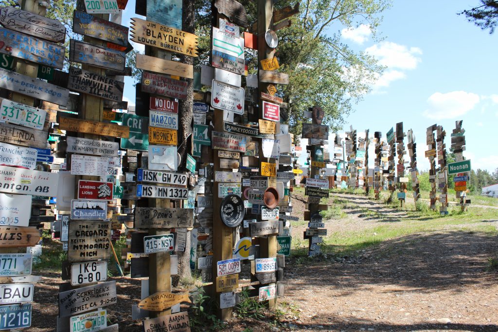
Explore the Kenai Peninsula before taking the Glenn Highway/Tok Cutoff from Anchorage to Tok. At Tok, take the Alaska Highway east to Watson Lake to see the Sign Post Forest, then backtrack 13 miles west and head south on the Cassiar/Highway 37 into British Columbia.
Cassiar Highway
Cassiar Highway 37 is popular with motorists who have driven the Alaska Highway and are looking for an alternate route for the drive back. The Cassiar accesses Stewart, BC, and Hyder, AK, an interesting side trip with glaciers (Bear and Salmon) and bear viewing (at Fish Creek).
West Access Route
The Cassiar junctions with Yellowhead Highway 16, which takes you east to Prince George, where you pick up the West Access Route south. Take a side trip to Wells and Barkerville for part of the Gold Rush Circle Route, then continue to the international border at Sumas and back down I-5 to Seattle, WA.
Inbound mileage
1,195 miles plus 3 to 10 days ferry travel time
Skagway to Dawson City: 442 miles
Dawson City to Fairbanks: 391 miles
Fairbanks to Anchorage: 362 miles
Outbound mileage
2,320 miles
Anchorage to Tok: 328 miles
Tok to Watson Lake: 669 miles
Watson Lake to Prince George: 761 miles
Prince George to Seattle: 562 miles

Comments are closed.