
Stretch your legs with one of our favorite hikes on the Seward Highway. The roadway, which connects Anchorage and Seward in southcentral Alaska, is recognized as a National Forest Scenic Byway, Alaska Scenic Byway, and All-American Road. Clearly it’s a beautiful place and enjoyable out your car’s windshield. Nothing compares to lacing up and immersing yourself in Alaska’s beauty.
Crow Pass Trail
This trail follows part of the historic Iditarod route. It is actually a 23-mile thru-hike that connects Girdwood to the Eagle River Nature Center. Hardy hikers looking for a multi-day excursion can tackle the whole trail for sights of glaciers, alpine lakes and waterfalls. Day hikers can tackle a few miles on either side of the trail for an equally rewarding journey.
It’s about three miles from the trailhead in Girdwood to Crystal Lake. The climb is moderate. Along the way there’s remnants from an old gold mine near the trail. Continue for about another mile past Crystal Lake for views of Raven Glacier.
Portage
Turn off the Seward Highway to Whittier/Portage Glacier Road to access this family friendly hike. The mostly flat trail follows close to Byron Creek for just under a mile to a viewing area and up close view of a glacier. The Forest Service recommends hiking the trail after late June or early July when the large cornices that overhang the valley have melted.
Unmaintained trail continues past the viewing area for another half mile up a talus slope.
Exit Glacier and Harding Ice Field
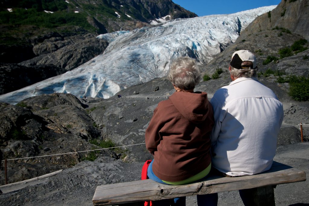
Near Seward, Exit Glacier is another family friendly adventure. The one-mile Glacier View Loop Trail is an accessible mix of pavement and compressed gravel. Jet off from the loop for a roughly half-mile journey to the Exit Glacier Overlook, which ends right above the glacier.
Hikers looking for a longer, more strenuous trip can tackle a trip to the source of Exit Glacier on the Harding Icefield Trail. Roughly four miles one way, the trail ascends from the valley floor to above the tree line and culminates with a breathtaking view of the sprawling icefield. The trail is steep. Hikers gain about 1,000 of elevation every mile.

Comments are closed.